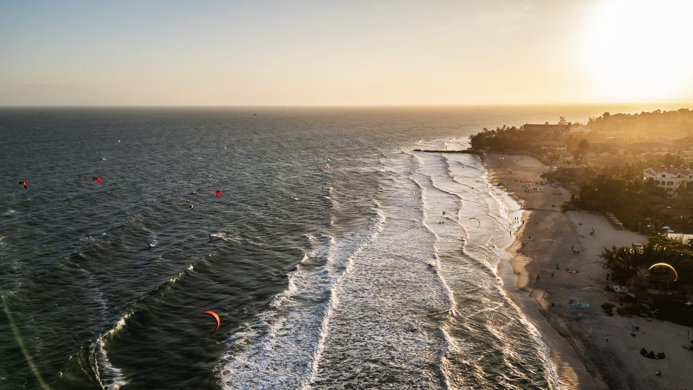
THE MUI NE
GUIDE
WIND, COAST AND A TWELVE-KILOMETRE STRIP
This coast makes sense once you understand the wind. Twelve months of it, measured ten minutes at a time by the station on this beach — and every place C2SKY sends its own guests to, with the coordinate it came from.
A local operating manual for a wind destination: the season, the shape of a day, the coast, getting here, and where to eat when it is flat. Written for somebody arriving on purpose.
A list of things to do. It names no business C2SKY does not send its own guests to, publishes no opening hour or price it cannot keep current, and prints no visa rule at all.
Wind, direction and temperature come from C2SKY’s own beach station — 50,609 measurements across twelve months. Every named place comes from the owner’s own guest guide, resolved to a verified coordinate.
CONTENTS
- PART ATHE PLACE
- 00START HERE
- 01WHAT “MUI NE” ACTUALLY MEANS
- 02THE COAST
- PART BTHE WIND
- 03READ THE WIND
- 04THE SHAPE OF A DAY
- 05THE SHAPE OF A YEAR
- 06WHEN TO COME
- PART CTHE WATER
- 07WHERE TO RIDE
- 08KITE, WING, LEARN
- PART DTHE TRIP
- 09GETTING HERE
- 10GETTING AROUND
- 11WHERE TO STAY
- PART ETHE DAYS
- 12NO-WIND DAYS
- 13EAT AND LOCAL LIFE
- 14PRACTICAL MUI NE
- PART FREFERENCE
- 15YOUR C2SKY WEEK
- 16THE REGISTER
- 17SOURCES AND CREDITS
START HERE
Mui Ne makes sense once you understand the wind. Everything else in this guide is downstream of that one fact.
WHAT YOU WILL BE ABLE TO DOFind the chapters that answer your own question, and know what this guide will and will not tell you.
This is the third C2SKY guide. The other two teach you to kitesurf and to wingfoil. This one is about the place you will do it in — a strip of coast on the south-east shoulder of Vietnam that gets a hard, clean, side-onshore wind for roughly half the year and almost nothing for the other half.
It is written for somebody who is coming here on purpose: to ride, to learn, to stay, or to keep somebody company who is doing one of those. It is not a list of ten things to do.
Five ways to read this
Nobody reads a guide from front to back. These are the five routes people actually take through it. Each is a reading order, not a summary — no chapter is repeated inside another one.
HERE FOR THE WIND
You already ride. You want to know if the week you booked works.
HERE TO LEARN
First course, or first proper one.
FIRST TIME IN MUI NE
You have never been, and you want the place to make sense.
STILL CHOOSING A MONTH
The trip is not booked and the dates are open.
TRAVELLING WITH NON-RIDERS
One of you rides. One of you does not.
What this guide is
- Measured where it can be. The wind chapters are built from twelve months of ten-minute readings taken by C2SKY’s own weather station on this beach — not from a forecast model, not from memory, and not from the marketing copy of a school with something to sell you.
- Local where it matters. Every restaurant, clinic, gym and shop named in these pages comes from C2SKY’s own guest guide, written by the person who runs the place. There is not one venue in here that somebody at C2SKY has not been to.
- Honest about what changes. No opening hours. No prices for things we do not sell. No bus departure times. All four go stale inside a year and a guide that prints them is lying to you eleven months out of twelve.
What it is not
How to read the marks
Four marks, used the same way as in the other two guides.
- KNOWSafe to read and act on.
- WATCHWhere this goes wrong, or what changes.
- DANGERInjury, not inconvenience.
- LOCAL NOTEC2SKY’s own, and only where verified.
WHAT “MUI NE” ACTUALLY MEANS
Mui Ne is not one beach. It is one road, about twelve kilometres of it, with the sea on the same side the whole way — and where you sit on that road decides how your day works.
WHAT YOU WILL BE ABLE TO DOSay where you are, what is within walking distance, and what needs a scooter.
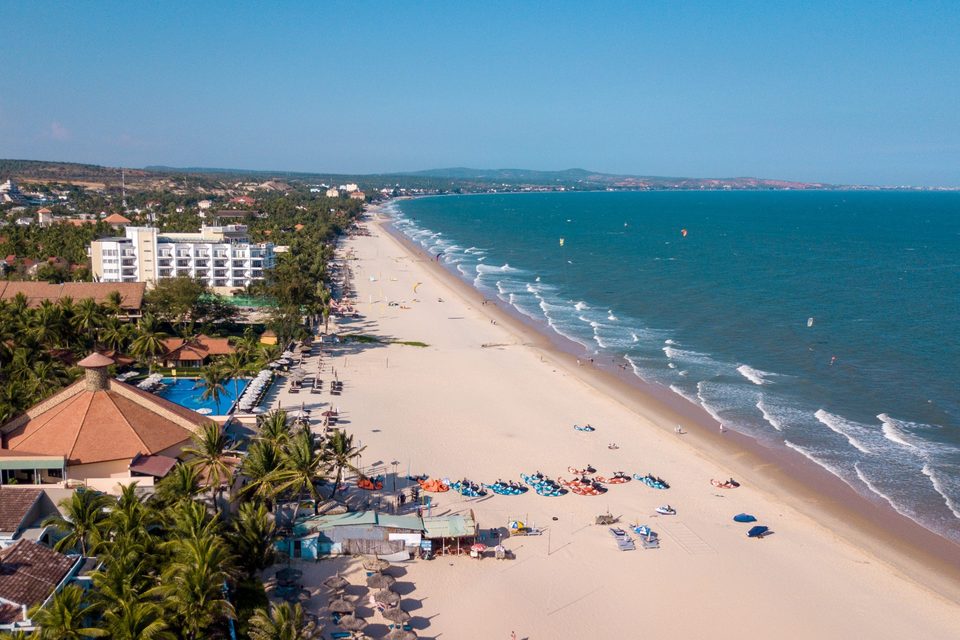
Almost everybody who says “Mui Ne” means the strip: a single coastal road running east from the edge of Phan Thiết out to a fishing harbour and, beyond it, the dunes. Hotels, kite schools, restaurants and repair shops sit along it in a line one building deep. There is no centre. There is only further east or further west.
The three names, and which one to use
You will meet three, and they do not mean the same thing.
| NAME | WHAT IT ACTUALLY IS | WHEN YOU WILL MEET IT |
|---|---|---|
| Phan Thiết | The city at the western end. The hospital, the supermarket, the railway station and the airport site are all here. | On a hospital sign, a train ticket, or an address that ends in a postcode. |
| Hàm Tiến | The western half of the strip, where C2SKY sits. Until 2025 it was its own administrative ward. | On old maps, hotel listings and every kite school’s address for twenty years. |
| Mũi Né | Strictly the cape and village at the eastern end — and since July 2025, also the name of the enlarged ward that swallowed Hàm Tiến. | On anything official written after mid-2025, and on this guide’s cover. |
Colloquially, “Mui Ne” means the whole strip and always has. Administratively, it now genuinely does.
The redrawing nobody told the travel industry about
On 1 July 2025 Vietnam carried out the largest administrative reform since reunification: sixty-three provinces became thirty-four, the entire district tier was abolished, and two thirds of all wards and communes were dissolved.
Bình Thuận was merged with Lâm Đồng and Đắk Nông into one province, keeping the name Lâm Đồng and governed from Đà Lạt, up in the hills. In the same reform, Hàm Tiến ward, Mũi Né ward and Thiện Nghiệp commune were merged into a single enlarged Mũi Né ward. Phan Thiết went from nineteen wards and communes to seven.
Where things are, from the C2SKY door
Straight-line distances from the school’s verified position. They are not drive times — the road is a road.
| WEST OF C2SKY | EAST OF C2SKY | ||
|---|---|---|---|
| Pharmacy, clinic | under 1 km | Gym, spa, trampoline club | about 1.3 km |
| Lotte Mart, Phan Thiết | about 9 km | Bus office | about 2 km |
| An Phuoc General Hospital | about 10.5 km | Food courts, beach club | about 3.7 km |
| Fuel | about 11 km | Morning market | about 5.8 km |
| Tà Cú mountain | about 36 km | Fishing village | about 6.2 km |
| Fairy Stream | about 6.9 km | ||
| Red sand dunes | about 11 km |
Everything east of the school is what you came to look at. Everything west is what you need when something has gone wrong.
THE COAST
The beach runs east-north-east and the sea is to the south-south-east. That geometry is the reason the season wind is side-onshore, and it is also the reason half the beachfront is a wall.
WHAT YOU WILL BE ABLE TO DORead the shoreline before you get here, and know which questions about a beach are worth asking a hotel.
Take the two verified positions at either end of the strip — the school and the fishing village — and the line between them bears 079°. Straight out to sea, at right angles, is 169°. Everything about riding here follows from those two numbers.
Why the season wind is the good kind
From November to April the wind arrives from the east. That is seventy-nine degrees off the shore normal — which means it blows along the beach from your left as you face the water, with just enough onshore component to push you gently back in rather than out.
In the quiet season the wind comes from the south and south-west instead — closer to straight onshore, and much lighter. Chapter 03 explains why the two halves of the year behave like different places.
The water
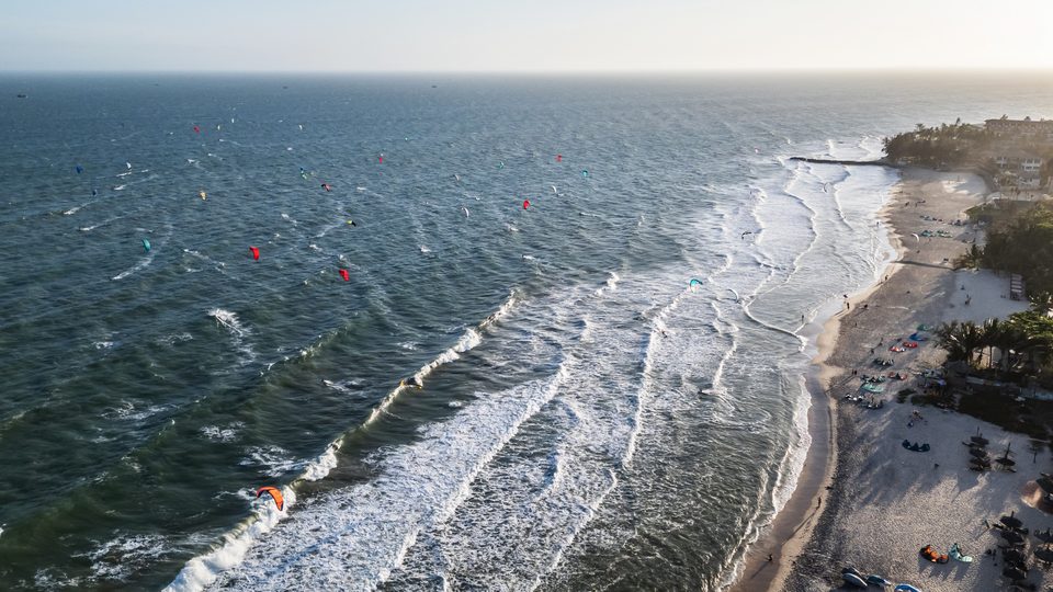
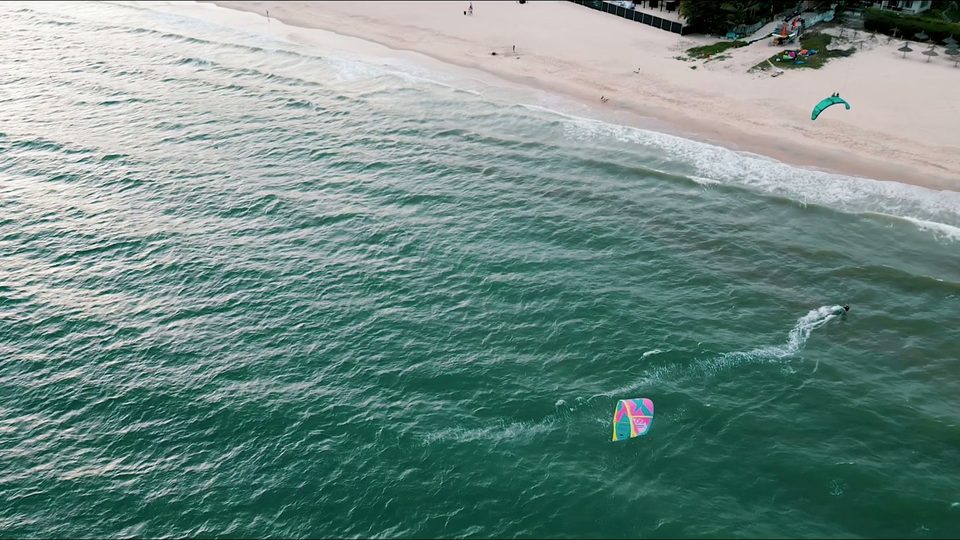
- Shallow, and shallow for a long way. The teaching area in front of the school stands up. That is the whole reason beginners come to this coast rather than a deep-water spot — you can stop, stand, and try the same thing again, forty times in an afternoon.
- Chop outside, not swell. The season wind builds a short wind chop beyond the shallows rather than a clean wave. It is not a wave spot and nobody honest will sell it to you as one.
- Warm. The station measures air, not water, but the air at the beach averages 26.6°C in the coolest month and 32°C in the hottest. Nobody here rides in a full wetsuit.
The seawalls, and why they matter to where you sleep
This coast erodes, and it has been engineered against for years. The province built about twelve kilometres of sea dyke and embankment along the Bình Thuận shoreline, including roughly three kilometres of it along the Hàm Tiến–Mũi Né seafront — the exact stretch most of the hotels sit on.
The academic picture is consistent and slightly uncomfortable: erosion here follows coastal construction, and studies of the neighbouring Đồi Dương beach conclude that without coastal works, no beach erosion is reported at all. Build a wall, and the beach in front of the next property along starts to go.
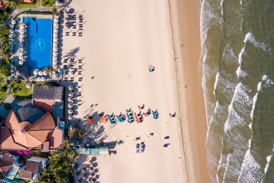
The erosion is also seasonal, and seasonal in a way that connects to everything else in this guide: the worst of it comes during the north-east monsoon. The wind that makes the season is the same weather that moves the sand.
READ THE WIND
Two completely different winds use this beach six months apart. One is a monsoon arriving as a hard easterly; the other is a local sea breeze that never really commits.
WHAT YOU WILL BE ABLE TO DOSay which wind you are looking at, from the direction alone, before you look at the speed.
Everything in this chapter and the two after it comes from one instrument: Windguru station 14164, titled “Mui Ne C2SKY, C2SKY LIVE WINDSTATION”. It is C2SKY’s own sensor, it sits on this beach, and it reports every ten minutes.
The figures below are computed from the twelve months between 1 February 2025 and 31 January 2026 — the one complete year in the record — which is 50,609 measurements. Monthly coverage runs from 88% to 99%.
The two winds
| NOVEMBER – APRIL | MAY – OCTOBER | |
|---|---|---|
| What it is | The north-east monsoon, bent along the coast | A local afternoon sea breeze |
| Direction at the beach | East, overwhelmingly. A little north-east. | South and south-west, roughly evenly split |
| Relative to the beach | Side-onshore from the left | Onshore to cross-onshore from the right |
| Character | Steady, builds through the day, holds late | Softer, later to arrive, gone earlier |
| What it is good for | Everything | Learning, light-wind foiling, patience |
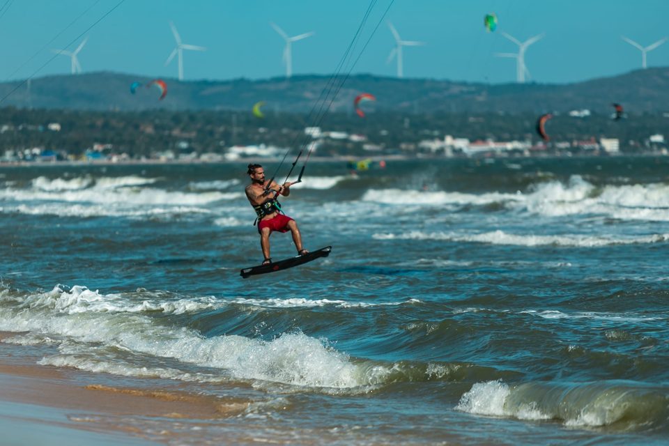
Direction shares are measured across powered samples — readings at or above 12 knots between 11:00 and 18:00.
October is the hinge
Look at the roses for the shoulder months and one thing stands out. In October the direction is genuinely undecided: about half the powered readings are easterly and the other half southerly or south-westerly. It is the only month in the record that cannot make up its mind.
By November the direction has flipped almost completely — two thirds easterly, a third north-east — but the strength has not arrived yet. The season changes direction about a month before it changes gear.
Is it gusty?
No, and this is the least-advertised good thing about the place. Across every powered reading in the main season, the ratio of gust to average wind sits at 1.10, and even at the ninetieth percentile it only reaches 1.13. A gusty inland or lee-shore spot commonly runs 1.4 or worse.
How hard does it actually blow?
Here the measured record says something more sober than the reputation. Across the whole year the best half-hour of an afternoon has a median of 12.1 knots; the ninetieth percentile is 17.7; the strongest single gust recorded in twelve months is 25.4 knots.
An independent reanalysis of the same coordinates over the same twelve months agrees closely — a median February afternoon peak of 14.6 knots against the station’s 15.1 — so this is not a sheltered or badly sited sensor reading low.
THE SHAPE OF A DAY
Nothing at dawn, everything after lunch. The curve is the same in both seasons; the quiet season just draws it smaller.
WHAT YOU WILL BE ABLE TO DOPlan a day here without wasting a morning waiting on a beach for wind that is not due for four hours.
If you take one thing from this guide, take this. The wind in Mui Ne is a thermal effect layered on a monsoon, and thermal effects run on the sun.
The clock, measured
| TIME | WHAT THE STATION MEASURES, MAIN SEASON | WHAT TO DO WITH IT |
|---|---|---|
| 00:00 – 06:00 | About 1 knot. Flat. | Sleep. |
| 07:00 | 2.5 kt and rising | The harbour, the market, the dunes. This is the window for everything that is not riding. |
| 09:00 | 6 kt | Breakfast. Rig later. |
| 11:00 | About 9 kt — and on a day that works, the first 12-knot reading lands at 11:10 | Be at the beach if you want the whole session. |
| 14:00 – 15:00 | 11.5 kt, the peak of the average day | This is the session. |
| 17:00 | 10.4 kt and falling | Still on. |
| 18:35 | The median last 12-knot reading of a working day | But the sun set an hour ago. See below. |
| 20:00 | 5 kt | Done. |
Means include calm days, so no individual day looks exactly like this — but every day has this shape.
The light goes before the wind does
This is the part nobody mentions. Mui Ne is at 10.9° north, so the day length barely moves — but the season runs through the shortest evenings of the year.
| MONTH | SUNRISE | SUNSET | WIND STILL AT 12 KT UNTIL (MEDIAN) |
|---|---|---|---|
| November | 05:43 | 17:21 | 18:35 |
| December | 05:57 | 17:27 | 18:35 |
| January | 06:10 | 17:43 | 18:35 |
| February | 06:08 | 17:55 | 18:35 |
| March | 05:55 | 17:58 | 18:35 |
| April | 05:37 | 17:58 | 18:35 |
Sun times computed for the C2SKY position, mid-month. The 12-knot figure is the median last reading on main-season days that produced a session.
What this means for a lesson
- A morning lesson is a beach-and-theory lesson, and that is a legitimate use of a morning — the kite handling, the safety systems and the self-rescue drill all happen better in light wind.
- The powered water time is early afternoon onward.
- If you have one day and one shot, do not book a 09:00 start and expect to be riding.
THE SHAPE OF A YEAR
December was the best month in the measured year and July the worst. The gap between them is not subtle.
WHAT YOU WILL BE ABLE TO DOChoose a month with the evidence in front of you, including the evidence that this is one year of it.
The chart below is the measured year, month by month, running November to October so that the season reads as one block rather than being split across a calendar boundary.
The table behind the chart
| MONTH | DAYS MEASURED | REACHED 12 KT | 2 HOURS AT 12 KT | MEDIAN PEAK KT | P90 PEAK KT | AFTERNOON AIR | DIRECTION |
|---|---|---|---|---|---|---|---|
| November | 30 | 40% | 13% | 10.8 | 17.7 | 32° | E 67% NE 31% |
| December | 31 | 81% | 65% | 14.9 | 18.6 | 31° | E 88% NE 12% |
| January | 30 | 67% | 57% | 13.9 | 18.1 | 30° | E 93% NE 7% |
| February | 28 | 64% | 57% | 15.1 | 18.7 | 31° | E 89% NE 11% |
| March | 31 | 58% | 52% | 14.0 | 19.6 | 32° | E 90% NE 10% |
| April | 30 | 53% | 47% | 12.8 | 17.9 | 34° | E 86% S 8% |
| May | 31 | 45% | 19% | 10.4 | 17.7 | 36° | S 62% E 25% |
| June | 30 | 43% | 20% | 11.5 | 15.6 | 35° | SW 67% S 33% |
| July | 28 | 36% | 0% | 11.4 | 13.3 | 35° | SW 91% S 9% |
| August | 31 | 55% | 10% | 12.0 | 13.9 | 35° | SW 61% S 39% |
| September | 28 | 50% | 36% | 12.0 | 16.2 | 35° | S 56% SW 44% |
| October | 31 | 35% | 23% | 8.0 | 17.4 | 34° | E 47% S 21% |
Station 14164, 2025-02-01 to 2026-01-31. Peak is the highest 30-minute rolling mean between 11:00 and 18:00 on that day. 2 hours at 12 kt is two consecutive hours at or above 12 knots in the same window — the column that answers “could I have had a session”.
What the shoulders actually do
- October is the worst month in this record on the two-hour measure except for high summer, and it is the month whose direction cannot settle. It is the tail of the quiet season, not the start of the good one.
- November has the season’s direction and none of its strength. 13% of days gave a two-hour window.
- April is the better shoulder by a distance: 47% of days gave a two-hour window, against November’s 13%. If you want quieter beaches and are willing to trade some certainty, take the back end of the season rather than the front of it.
- May is genuinely mixed — 45% of days reached 12 knots at some point, but only 19% held it for two hours. That is the signature of a sea breeze rather than a monsoon.
Wind against heat
The windy months are the cool ones, and that is not a coincidence: the same north-east monsoon that brings the easterly also takes four or five degrees off the afternoon. Mean afternoon air at the beach runs 31.2°C in December and 29.7°C in January, against 34.8 to 35.5°C from May to August.
The honest caveat, restated
WHEN TO COME
If the wind is the point, come between December and March. Everything else is a trade, and the trades are worth knowing.
WHAT YOU WILL BE ABLE TO DOPick a month for the trip you are actually taking, rather than the one somebody else took.
Four different people should book four different months. Here is the whole decision in one table.
| IF YOU ARE… | COME | WHY | WHAT YOU GIVE UP |
|---|---|---|---|
| Coming for the wind, full stop | December – March | The four months where the measured record gives a two-hour window on half the days or better, at the coolest air temperatures of the year. | The busiest beaches and the highest season prices. |
| Learning, and want steady rather than strong | January – March | Same reliability, and the strongest single readings of the year land in March. | Nothing much. This is the best window for a first course. |
| Wanting the season without the crowd | April | Still gave a two-hour window on 47% of days, and it is measurably quieter. | About a fifth of the reliability, and it is getting hot — 34°C afternoons. |
| Coming for Vietnam, and riding if it happens | May – September | The country is at its cheapest and emptiest here, and light-wind foiling days do occur. | Most of the wind. July gave a two-hour window on no days at all in this record. |
All figures from the measured year, 1 Feb 2025 to 31 Jan 2026, station 14164.
Two months to think twice about
How long to stay
The honest arithmetic, using the measured numbers. In the best month in the record, roughly two days in three gave a real session. Over a week that is about four or five riding days; over four days it is two or three.
WHERE TO RIDE
Two spots, twenty minutes apart, that do different jobs. One of them is a different place with a different bottom and a different season.
WHAT YOU WILL BE ABLE TO DOSay which of the two you should be at, and why.
C2SKY teaches at two places on this coast, and they are not variations on each other.
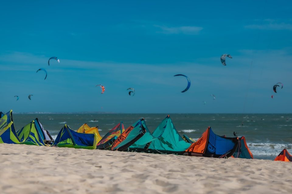
The kite beach
- In front of the school. Everything — the rack, the storage, the instructors, the cáfe — is on the same sand.
- Standing depth for a long way out, then chop beyond it.
- Side-onshore from the left through the main season, from the measured record: east in 88% of powered readings, north-east in most of the rest.
- This is where every kite lesson starts and where most sessions happen.
Wingfoil Beach
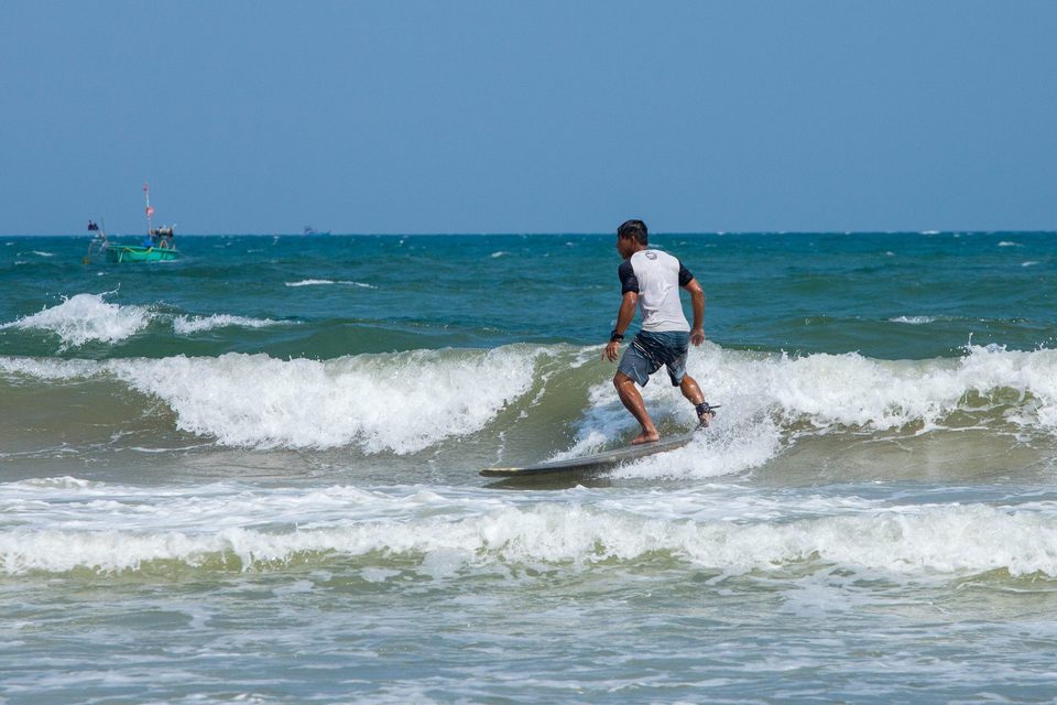
The flat-water spot C2SKY uses for wingfoil and for first days on a board. Shallower and calmer than the kite beach, more open water once you are out, and better for foiling and downwinders. Seasonal — roughly October to the end of April.
What the coast is not
Reading the day before you go down
- The camera beats the forecast. C2SKY runs a beach camera and a live weather station. A model tells you what a 28-kilometre grid cell thinks; the camera tells you what is happening on this sand.
- Do not write off a light morning. The measured curve says the average main-season day is at 6 knots at nine and 11.5 at three. A flat morning is the normal state of a good day.
- Do not write off a light evening either. On days that work, the wind holds past sunset more often than not.
KITE, WING, LEARN
What the wind actually lets you do here, and roughly how long each of them takes.
WHAT YOU WILL BE ABLE TO DOTurn a week of measured wind into a realistic plan for what you will be able to do at the end of it.
This guide does not teach technique — the C2SKY Kitesurfing Guide and Wingfoil Guide do that, and an instructor does the rest. What belongs here is the local half: what this particular wind and this particular water make easy, and what they make slow.
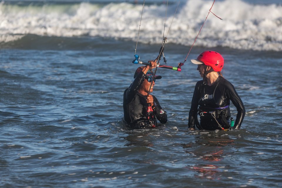
Why beginners do well on this coast
- You can stand up. The shallow area in front of the school means a beginner can stop, reset and repeat rather than swim.
- The wind is smooth. A gust factor of 1.10 through the season, measured. A learner can build a mental model of what the kite is doing because the kite keeps doing the same thing.
- It is side-onshore. Mistakes drift you along the beach and slightly toward it, which is the forgiving direction.
- It is not overpowered. A median good afternoon in the mid-teens is the right amount of wind to learn in.
What the season costs an advanced rider
Wingfoil
The wing season here runs roughly October to April at the seasonal spot, and the light-wind character of the shoulder months suits foiling better than it suits kiting — a foil gets going in wind a twin-tip cannot use.
Planning a week honestly
| MONTH BOOKED | DAYS WITH A 2-HOUR WINDOW, MEASURED | EXPECT, OVER SEVEN DAYS |
|---|---|---|
| December | 65% | About four or five riding days |
| January | 57% | About four |
| February | 57% | About four |
| March | 52% | About three or four |
| April | 47% | About three |
| November | 13% | One, and be pleased with it |
| July | 0% | Bring a book, or a foil, or both |
One measured year. Treat these as the shape of the odds, not as a promise.
GETTING HERE
Mui Ne is a drive from Ho Chi Minh City, not a flight. Since 2023 it is a much shorter drive than the guidebooks in your hotel lobby still say.
WHAT YOU WILL BE ABLE TO DOChoose a route in, and know which parts of that decision you must check yourself.
Almost everybody arrives through Tân Sơn Nhất (SGN) in Ho Chi Minh City and then travels roughly two hundred kilometres east along the coast.
The road changed in 2023
The Dầu Giây – Phan Thiết expressway — 99 km, opened April 2023 — connects to the existing Ho Chi Minh City expressway and takes the whole journey off the old national highway. Reporting at the time put the change at roughly five hours down to about two and a half.
The four ways
| ROUTE | WHAT IT IS | WHAT TO CHECK |
|---|---|---|
| Private car | Door to door, one car, priced per car rather than per person or per kilometre. C2SKY runs its own transfer from SGN, and will collect from a Ho Chi Minh City hotel just as readily as from the terminal. | Send your flight number. The driver confirms the plan the day before. |
| Coach | Sleeper and limousine buses run the expressway. The owner’s own guest guide calls it a cheap ride and a slow journey, four to five hours. | Check the current schedule. Operators, pick-up points and timings all change. |
| Train, then a car | Phan Thiết sits at the end of a 15 km branch off the main Reunification line, about 187 km from Saigon. The SPT services run daily. | Check the current schedule. The station is in Phan Thiết, so you still need a car for the last 20 km. |
| Cam Ranh (CXR) | The airport to the north, for anyone coming down the coast rather than up from the city. C2SKY will run it, but no rate for it sits on the published sheet. | Ask for a quote. It is priced by hand. |
Every route above ends on the same beach road. None of the schedules or fares is printed in this guide, because none of them can be kept current in a PDF.
The airport that is coming, and is not here yet
There is a Phan Thiết airport project, at Thiện Nghiệp, inside what is now Mũi Né ward. The military runway opened in late 2025. The civil terminal broke ground on 27 April 2026, is budgeted at about VND 3.9 trillion across roughly 75 hectares, is being built to 4E standard for an initial capacity around two million passengers a year, and the developer has committed to operation in 2027.
Arriving
- Get a local SIM or an eSIM at the airport, before the drive. Chapter 14.
- Draw cash in the city if you like, though there are machines on the strip.
- Board bags: tell whoever is driving. It changes which vehicle turns up.
- Nothing about your arrival time changes when the wind blows. If you land at eight in the morning you have not missed anything; see chapter 04.
GETTING AROUND
One road, twelve kilometres, no public transport worth the name and a ride-hailing app that is not as reliable here as it is in the cities.
WHAT YOU WILL BE ABLE TO DOMove around the strip without stranding yourself at eleven at night.
The four options, in the order most people use them
| WHAT IT IS | THE CATCH | |
|---|---|---|
| Scooter | The default, and the only thing that makes the dunes and the harbour convenient. Rentals are easy to arrange and will usually be delivered to you. | Helmet on. Check that your travel insurance actually covers you — many policies require a licence valid for the engine size, and will decline without one. |
| Walking | If you are staying near the centre, most of your day is walkable. That is the entire argument for staying close to the water. | The strip is long and thin. A kilometre in the wrong direction in the middle of the day is genuinely unpleasant at 35°C. |
| Taxi | Metered taxis operate here, and hotels will call one. | We do not publish fares we do not set. |
| Private car via C2SKY | For arrival, departure and the longer trips — the white dunes, Tà Cú. | Priced per car. Ask. |
About the app
Distances that decide things
From the C2SKY door, straight line.
| WALKABLE | SCOOTER | CAR, OR A TOUR |
|---|---|---|
| ATM, 80 m | Gym and spa, 1.3 km | Red dunes, 11 km |
| Clinic, 500 m | Bus office, 2.0 km | Lotte Mart, 9 km |
| Pharmacy, 900 m | Food courts, 3.7 km | Hospital, 10.5 km |
| Morning market, 5.8 km | Tà Cú mountain, 36 km | |
| Fishing village, 6.2 km | ||
| Fairy Stream, 6.9 km |
Straight-line distances from verified coordinates. Not drive times.
WHERE TO STAY
There is no good or bad end of the strip. There is only near your gear and far from it, and the decision is about walking.
WHAT YOU WILL BE ABLE TO DOChoose a zone on the strip for the trip you are taking, and ask a property the two questions that actually matter.
This guide does not rank hotels. It has not stayed in them, it cannot keep a ranking current, and a comparison written from a distance is worth nothing to you. What it can do is explain the geography, because the geography is stable and it is what people get wrong.
The three zones
| ZONE | WHAT IT IS | SUITS |
|---|---|---|
| West — the Hàm Tiến end | Where C2SKY, most of the kite schools and the closest clinics and shops are. Phan Thiết’s hospital and supermarket are a short drive further west. | Anybody whose day is built around the water. Walk to your gear, walk back. |
| Middle | Food courts, the beach clubs, most of the nightlife, laundry. | People who want to eat and go out on foot and do not mind a short ride to the beach. |
| East — toward the harbour | The fishing village, the morning market, Fairy Stream and the dunes beyond. | People here for the place more than the wind, and anybody who wants the harbour at six in the morning without an alarm and a scooter. |
The whole strip is about twelve kilometres. “Far” here means twenty minutes, not an hour.
The one rule
The two questions to ask a property
- “Is there beach in front of you at high tide, or a seawall?” About three kilometres of the Hàm Tiến–Mũi Né seafront is engineered sea dyke. A listing photograph taken at low tide cannot tell you which side of that you are booking. Chapter 02.
- “How far is it to walk to the school?” Ask in metres, not in minutes, and not “is it close”.
C2SKY’s own rooms
C2SKY runs its own accommodation, which exists for exactly the reason above: it puts riders inside walking distance of their gear and takes the transport decision out of the morning. Details, rooms and prices live on the site rather than in this guide, because they change and this file does not.
NO-WIND DAYS
On this coast a flat day is not a wasted day, and it is not a consolation prize either. Most of what people remember about Mui Ne happens before nine in the morning.
WHAT YOU WILL BE ABLE TO DOFill a day with no wind in it without ending up in a souvenir shop.
Two things make the flat day work here. The first is that everything worth seeing is inside twelve kilometres. The second is that all of it is better early, which is exactly when there is no wind anyway.
The five beats
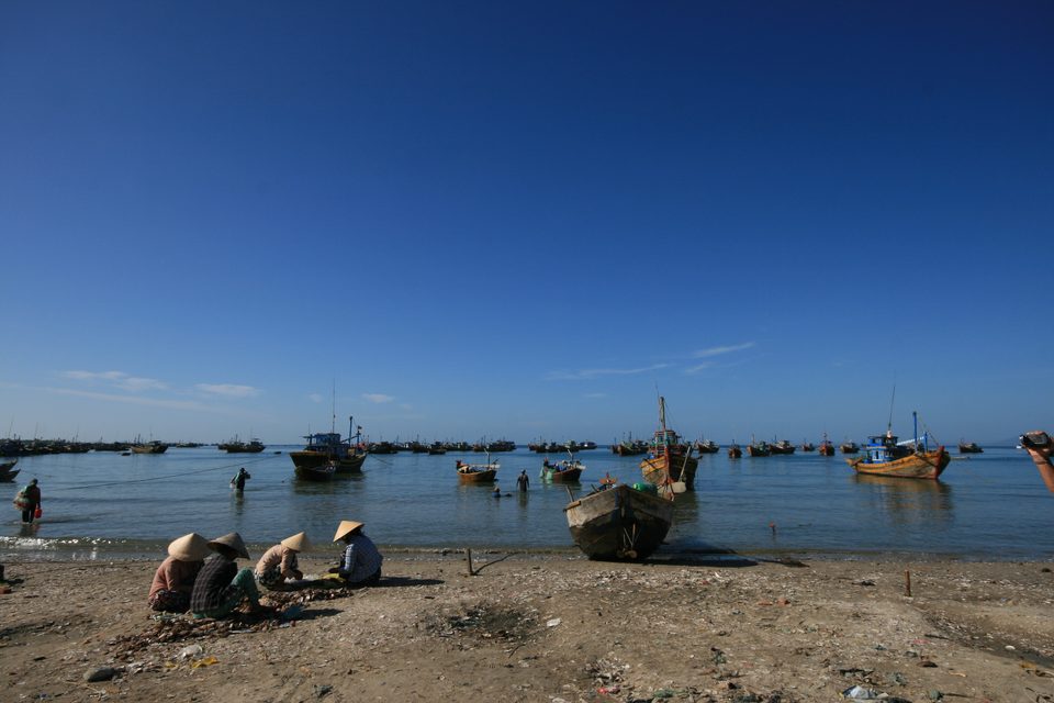
| 06:30 — the harbour | The fishing village is a working harbour, not an attraction. Round basket boats land the morning catch and it is over by nine. | 6.2 km east |
| 09:00 — the market, or the dunes | The morning market runs early. The red dunes are close and the colour is best in the first hours of light; by midday it flattens and the crowd arrives. | 5.8 and 11 km east |
| 12:00 — out of the sun | The measured afternoon mean touches 35.5°C in the quiet season and the station has recorded 43.6°C. Eat, sleep, do the work you were avoiding. This is the flat middle of every Mui Ne day, wind or not. | — |
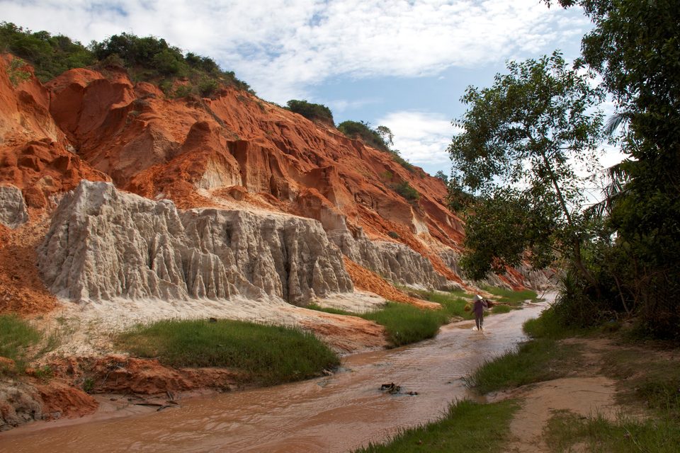
| 15:30 — Fairy Stream | A shallow warm stream you walk up barefoot between red and white sandstone. Half an hour each way and no equipment. Shaded most of the way. | 6.9 km east |
| 17:30 — look again | In the main season the wind routinely holds past sunset. Open the camera before you write the day off; the beach is a short walk. | — |
Times are the shape of a day here, not opening hours. This guide publishes no opening hours because it cannot keep them current.
The further trips
- The white dunes — Bàu Trắng. Much bigger, much whiter and further out than the red dunes, with a freshwater lake beside them. A genuine desert landscape, and worth the drive. Better at sunrise, before the heat.
- Po Shanu Cham towers — brick towers on the hill above Phan Thiết, and the view back down over the bay. Late afternoon.
- Tà Cú mountain — about 36 km west, and the owner’s own guest guide singles it out as the thing to do on a light-wind day.
- Enduro through the red dunes — the owner names an operator for this; see the register.
Training and recovery
A flat morning is also the one time in a kite trip when you can do something with the rest of your body. The owner’s guide names four places for it.
- Trampoline Club "Impulse"1.2 KM NE
The owner calls it Jump: boxing, trampoline, handstands, calisthenics classes and the yoga schedule, open till eight. Outdoor gym till 20:30.
Four separate entries on the owner's list — Jump, Yoga, Trampoline and Calisthenics — all resolve to this one place.
- Botanica Spa1.3 KM NE
Very good massages. Mention Liz for a discount.
- Vegeta Gym5.7 KM E
Weights, machines and air conditioning
- T&T Muay Thai Boxing Gym8.5 KM E
Muay Thai and boxing. The owner's line: the best Muay Thai classes.
FROM C2SKY’S OWN GUEST GUIDE · POSITIONS RESOLVED 2026-09-01 · NO OPENING HOURS OR PRICES ARE PUBLISHED
And what to see
- Ham Tien MarketChợ Hàm Tiến5.8 KM E
The Mui Ne market. Five in the morning until ten.
The owner's link is a search for "mui ne market"; Google resolves it to Ham Tien Market at the harbour end of the strip, 5.8 km east of C2SKY.
- Mui Ne Fishing VillageLàng chài Mũi Né6.2 KM E
A working harbour, not an attraction. The round basket boats land the morning catch and the whole thing is over by nine.
- Fairy StreamSuối Tiên6.9 KM E
A shallow warm stream you walk up barefoot, between red and white sandstone. Half an hour each way, no equipment.
- Red Sand DunesĐồi Cát Hồng11.2 KM E
The closer dunes, red-orange and small enough to walk. Tours available.
- Ta Cu MountNúi Tà Cú36.3 KM W
Outside Mui Ne. The owner's note: great for light-wind days.
- White Sand DunesBàu TrắngNO PIN
Bigger, whiter and further out — a real desert with a freshwater lake beside it. Worth the drive.
Named on the site since August 2026. No verified geocode, so no pin.
- Po Shanu Cham TowersTháp Po ShanuNO PIN
Cham brick towers on the hill above Phan Thiet, and the view back down over the bay.
Named on the site since August 2026. No verified geocode, so no pin.
FROM C2SKY’S OWN GUEST GUIDE · POSITIONS RESOLVED 2026-09-01 · NO OPENING HOURS OR PRICES ARE PUBLISHED
EAT AND LOCAL LIFE
Everything named in this chapter came from the person who runs C2SKY. Nothing in it came from a review site, and nothing in it was chosen by anybody who has not eaten there.
WHAT YOU WILL BE ABLE TO DOEat well on the strip without reading a single review.
This is the shortest editorial in the guide, because it is not our list. C2SKY keeps a welcome guide for its own guests, written by the owner, with a map link against every entry. Those links were resolved on 1 September 2026 and this is what came back.
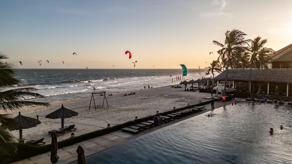
- The beach café at C2SKYC2SKYAT C2SKY
Illy espresso, tropical juices, toasties and sandwiches, and the only real ice cream in town — New Zealand Natural
- Sandals Restaurant and Bar0.3 KM E
For a romantic dinner or a special occasion
- Good Morning Vietnam0.6 KM NE
Delicious Italian food
- El Latino2.4 KM NE
Nice Mexican restaurant
- Choi Oi2.6 KM NE
Authentic Vietnamese home cooking
- Mr. Burger3.5 KM E
Good burger place, open till 5am
- Feed Your Soul3.7 KM E
Fresh, healthy, homemade vegetarian — the owner's own must-go
- Pit Stop Food Court3.8 KM E
Hungarian, Piri Piri, Mexican — and a good spot to sit
- Phap Duyen vegetarian restaurant5.9 KM E
Nice vegetarian restaurant
- Dong Vui Food Court6 KM E
Thai, Indian, Vietnamese and more
- Pappa Goulash — Hungarian RestaurantNO PIN
Hungarian restaurant
The owner's link is a Knowledge Graph entry, not a map pin. Name verified, position not. Search it rather than navigating to a number we do not have.
FROM C2SKY’S OWN GUEST GUIDE · POSITIONS RESOLVED 2026-09-01 · NO OPENING HOURS OR PRICES ARE PUBLISHED
Drink, and the sunset
- Nirvana Beach Club3.8 KM E
After ten, for drinks and dancing
- Pineapple Mũi Né6.2 KM E
Lounge bar. The owner's line is: the best sunset in Mui Ne
- Muine Pirate Restaurant & Live Music Bar (Hải Tặc Mũi Né)NO PIN
Live music
Knowledge Graph entry, no map pin. Name verified, position not.
FROM C2SKY’S OWN GUEST GUIDE · POSITIONS RESOLVED 2026-09-01 · NO OPENING HOURS OR PRICES ARE PUBLISHED
The food you will actually eat
- Seafood, at the harbour end. The boats land in the morning; the restaurants are downstream of that. It is the category everybody asks about first and it is the one the geography actually delivers.
- Vietnamese, at local prices. The strip runs the full range from resort dining to a plastic-stool com tấm, and the second is both better and a tenth of the price.
- Coffee. Vietnamese coffee is strong, sweet and served over ice, and it is one of the genuine pleasures of a flat morning.
- Western, in week two. No judgement. The owner’s list covers Italian, Mexican, Hungarian and a burger place open until five in the morning, which tells you something about the strip.
Two more from the owner’s guide
Not food, but they sit in the same document and belong to the same idea — things C2SKY sends its own guests to.
- Balu Ocean — handmade jewellery, each piece set individually in bronze, silver or gold. The owner’s note is that you can choose your own stone, and that you should just ask at the school to see the pieces.
- Kite, wing and board sales — new and second-hand. Ask Liz on WhatsApp for prices or a demo.
PRACTICAL MUI NE
Money, a SIM, a doctor and the sun. Four things that are boring until one of them is the only thing that matters.
WHAT YOU WILL BE ABLE TO DOHandle the ordinary problems of a fortnight here without losing a riding day to one of them.
Medical
There is a clinic within walking distance of the school, a pharmacy a little further, and a general hospital in Phan Thiết. All four are on the owner’s own list; all four are positioned.
- ATM, VietinBank0.1 KM NE
Outside Seahorse Resort
The owner's link is a bare coordinate, not a named business, so this row has a position and no place record behind it.
- Dr Dong Polyclinic & Pharmacy0.5 KM NE
Local clinic
- Quiksilver0.8 KM NE
Supporting local riders. Mention C2SKY for a discount.
- MEDiCARE0.9 KM NE
Drugstore and pharmacy
- Vita Clinic & Pharmacy1.4 KM NE
Local clinic
- Hải Đăng phone and laptop repair1.5 KM NE
SIM cards and repairs. The owner names Viettel or Vinaphone as the networks.
- Muine Laundry2.6 KM NE
Clean, quick, a safe bet
- Lotte Mart Phan Thiết9 KM W
The mall in Phan Thiet, five floors
The owner's guide writes "Lotto Mart". The resolved name is Lotte Mart.
- An Phuoc General Hospital10.5 KM W
The general hospital, in Phan Thiet
- Moreta PayNO PIN
Pay like a local with a QR code. The owner calls it a must-get app.
An app, not a place.
FROM C2SKY’S OWN GUEST GUIDE · POSITIONS RESOLVED 2026-09-01 · NO OPENING HOURS OR PRICES ARE PUBLISHED
Money
- The currency is the Vietnamese đồng. Cash still matters here more than in the cities.
- There is an ATM about eighty metres from the school. The owner’s guide names it as the VietinBank machine outside the Seahorse resort.
- QR payment is normal and widely accepted. The owner’s guide singles out one app for it — see the register — and calls it the easiest and lowest-fee way to send or receive money while you are here.
- This guide publishes no prices, no exchange rates and no fees.
Phone and data
A local SIM or an eSIM is cheap and makes everything else easier — maps, the ride-hailing app, WhatsApp to the school. The owner’s guide names Viettel and Vinaphone as the networks, and a shop on the strip that sells SIMs and repairs phones. Buy it at the airport if you can; buy it on the strip if you did not.
Sun, heat and water
The coolest month in the measured record is January, mean 26.6°C, with a single reading of 19.7°C. A January dawn on a scooter is genuinely cold in board shorts.
Entry and visas
Language and manners
- English is widely spoken along the strip and much less so in Phan Thiết. Learn cảm ơn — thank you.
- Take your shoes off where other shoes are off.
- The fishing village is somebody’s workplace at six in the morning. Photograph it the way you would want your own workplace photographed.
- Bargaining is normal in a market and is not normal in a restaurant.
Kit
- Bring the big kite. See chapter 08.
- Shorty or board shorts. Nobody rides here in a full wetsuit.
- Impact vest and helmet for lessons — the school has them, but a helmet that fits you fits better.
- A dry bag. Sand and salt get into everything on a beach with this much wind.
- Spare lines and a repair kit if you are here for a month. There is a surf shop on the strip; there is not a kite shop on every corner.
YOUR C2SKY WEEK
One week, built around the wind rather than against it.
WHAT YOU WILL BE ABLE TO DOArrive with a plan that survives contact with a flat Tuesday.
This is not a schedule. It is the shape a good week here takes, and the point of it is that the non-riding half is planned rather than improvised at nine in the morning with nothing to do.
| MORNING | AFTERNOON | |
|---|---|---|
| Arrival day | Travel. See chapter 09. | Walk the strip. Find the ATM, the pharmacy and where you will eat. Do not try to ride on the day you land. |
| Day 2 | Lesson one, on the sand. Kite handling, the safety system, the self-rescue drill — all better in light wind. | Water time as the wind builds through eleven and twelve. |
| Day 3 | Harbour at half past six, back for breakfast. | The main session. This is the peak-wind day of the week if the forecast allows. |
| Day 4 — if flat | The dunes, early, or the white dunes as a longer trip. | Out of the sun, then look at the camera again at half past five. |
| Day 4 — if windy | Rest, eat, stretch. Chapter 12 has the gyms. | Ride. |
| Day 5 | Fairy Stream, or the market. | Session. By now you know what eleven o’clock looks like here. |
| Day 6 | Nothing. Deliberately. | The longest session of the week — six or seven hours of usable wind is a median main-season day, not a lucky one. |
| Departure day | One last look at the water. | Travel. Confirm the car the day before, not the morning of. |
Built from the measured session clock in chapter 04 and the flat-day itinerary in chapter 12.
Three things that make a week work
- Do not book the morning. The wind is an afternoon event here and everything worth seeing is a morning event. That is a gift, not a conflict.
- Do not chase a forecast up the coast. A model reads a grid cell; the beach camera reads the beach.
- Plan one flat day in. In the best month in the record, one day in three did not produce a session. Planning for that is the difference between a rest day and a disappointment.
If you are travelling with somebody who does not ride
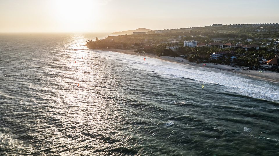
This is the question C2SKY gets asked most and the strip answers it better than most wind destinations. The riding window is 11:00 to sunset. Everything else — the harbour, the market, the dunes, the stream, the spa, the food — happens outside it, is inside twelve kilometres, and does not need a kite. A non-rider here is not waiting on a beach.
THE REGISTER
Every place named in this guide, on one true-scale map, with the coordinate it came from.
WHAT YOU WILL BE ABLE TO DOFind anything in this guide on a map, or hand somebody a phone with the right pin already open.
The map below is not a sketch. Every pin is plotted from the latitude and longitude behind the owner’s own map link, on a rotated but true-scale projection, with a scale bar to prove it.
The register
Numbered west to east along the coast, matching the map. Distances are straight-line from the C2SKY marker.
| # | PLACE | CATEGORY | FROM C2SKY | COORDINATE |
|---|---|---|---|---|
| 01 | Ta Cu Mount Núi Tà Cú | SEE | 36.3 KM W | 10.8281, 107.8828 |
| 02 | Petrolimex Station No. 106 | MOVE | 11.4 KM W | 10.9364, 108.0896 |
| 03 | An Phuoc General Hospital | PRACTICAL | 10.5 KM W | 10.9323, 108.0979 |
| 04 | Lotte Mart Phan Thiết | PRACTICAL | 9 KM W | 10.9387, 108.1109 |
| 05 | Mũi Né Enduro Travel (Black Desert) | MOVE | 5.5 KM W | 10.9331, 108.1439 |
| 06 | The C2SKY transfer drop | MOVE | 0.2 KM S | 10.9408, 108.1939 |
| 07 | The beach café at C2SKY | EAT | AT C2SKY | 10.9428, 108.1937 |
| 08 | ATM, VietinBank | PRACTICAL | 0.1 KM NE | 10.9434, 108.1940 |
| 09 | Sandals Restaurant and Bar | EAT | 0.3 KM E | 10.9431, 108.1965 |
| 10 | Dr Dong Polyclinic & Pharmacy | PRACTICAL | 0.5 KM NE | 10.9456, 108.1974 |
| 11 | Good Morning Vietnam | EAT | 0.6 KM NE | 10.9461, 108.1984 |
| 12 | Quiksilver | PRACTICAL | 0.8 KM NE | 10.9466, 108.1994 |
| 13 | MEDiCARE | PRACTICAL | 0.9 KM NE | 10.9473, 108.2007 |
| 14 | Trampoline Club "Impulse" | TRAIN | 1.2 KM NE | 10.9488, 108.2031 |
| 15 | Botanica Spa | TRAIN | 1.3 KM NE | 10.9493, 108.2035 |
| 16 | Vita Clinic & Pharmacy | PRACTICAL | 1.4 KM NE | 10.9491, 108.2053 |
| 17 | Hải Đăng phone and laptop repair | PRACTICAL | 1.5 KM NE | 10.9492, 108.2054 |
| 18 | Hanh Cafe | MOVE | 2 KM NE | 10.9512, 108.2099 |
| 19 | El Latino | EAT | 2.4 KM NE | 10.9526, 108.2134 |
| 20 | Choi Oi | EAT | 2.6 KM NE | 10.9530, 108.2147 |
| 21 | Muine Laundry | PRACTICAL | 2.6 KM NE | 10.9532, 108.2149 |
| 22 | Mr. Burger | EAT | 3.5 KM E | 10.9547, 108.2231 |
| 23 | Feed Your Soul | EAT | 3.7 KM E | 10.9550, 108.2255 |
| 24 | Pit Stop Food Court | EAT | 3.8 KM E | 10.9550, 108.2257 |
| 25 | Nirvana Beach Club | DRINK | 3.8 KM E | 10.9550, 108.2257 |
| 26 | Vegeta Gym | TRAIN | 5.7 KM E | 10.9544, 108.2442 |
| 27 | Ham Tien Market Chợ Hàm Tiến | SEE | 5.8 KM E | 10.9542, 108.2451 |
| 28 | Phap Duyen vegetarian restaurant | EAT | 5.9 KM E | 10.9539, 108.2469 |
| 29 | Dong Vui Food Court | EAT | 6 KM E | 10.9538, 108.2472 |
| 30 | Pineapple Mũi Né | DRINK | 6.2 KM E | 10.9515, 108.2496 |
| 31 | Mui Ne Fishing Village Làng chài Mũi Né | SEE | 6.2 KM E | 10.9533, 108.2495 |
| 32 | Fairy Stream Suối Tiên | SEE | 6.9 KM E | 10.9512, 108.2564 |
| 33 | T&T Muay Thai Boxing Gym | TRAIN | 8.5 KM E | 10.9649, 108.2686 |
| 34 | Red Sand Dunes Đồi Cát Hồng | SEE | 11.2 KM E | 10.9493, 108.2964 |
Named in this guide with no verified position, and therefore no pin: Pappa Goulash — Hungarian Restaurant, Muine Pirate Restaurant & Live Music Bar (Hải Tặc Mũi Né), White Sand Dunes, Po Shanu Cham Towers, Moreta Pay. Each is linked by name search so Google resolves it rather than this guide guessing.
What is deliberately not on this map
- Wingfoil Beach. C2SKY teaches there and no verified coordinate for it exists in any C2SKY source. It is named in chapter 07 and given no pin.
- C2SKY’s own accommodation. Its address is not published yet, and a place register is exactly where an unapproved address would leak.
- Every business the owner did not name. Not one restaurant, hotel or shop in this guide came from anywhere else.
SOURCES AND CREDITS
Where every number in this guide came from, and which of them will go stale first.
WHAT YOU WILL BE ABLE TO DOCheck anything in here yourself, and know which pages to distrust in a year.
The wind
Every wind, direction and temperature figure in chapters 03 to 08 is computed from Windguru station 14164 — “Mui Ne C2SKY, C2SKY LIVE WINDSTATION” — C2SKY’s own sensor on this beach, reporting at ten-minute cadence.
| Analysis window | 1 February 2025 – 31 January 2026 |
| Measurements in that window | 50,609 |
| Monthly coverage | 88% to 99% |
| Full record held | 13 January 2025 onward |
| Retrieved | 1 September 2026 |
| Cross-checked against | the ECMWF ERA5 reanalysis at the same coordinates over the same window, which agrees on direction and on magnitude |
Definitions, so you can reproduce these: an afternoon peak is the highest 30-minute rolling mean between 11:00 and 18:00 on that day. A usable window is two consecutive hours at or above the threshold in the same period.
The places
Every restaurant, bar, clinic, gym, shop and landmark named in this guide comes from C2SKY’s own guest welcome guide, written by the owner. Its map links were resolved to canonical names, coordinates and Google feature ids on 1 September 2026. No place in this guide came from anywhere else, and none was added by us.
The photographs
Every photograph in this guide is C2SKY’s own except two, and both of those are credited under the picture as well as below. Four of the C2SKY frames are stills lifted from the school’s own brand film, which is why they are wider and slightly softer than the rest.
Image credits
Every other photograph in this guide is C2SKY’s own. These are not, and they are used under the licence named beside each one.
- Fairy Stream — the shallow stream between red and white sandstone. Jean-Marie Hullot · CC BY 3.0, 2011. https://commons.wikimedia.org/wiki/File:Su%E1%BB%91iTi%C3%AAn(M%C5%A9i_N%C3%A9)JMHullot.jpg
- Mui Ne fishing harbour — the fleet at anchor, round basket boats, the catch being worked on the sand. ruben i · CC BY 2.0, 2009. https://commons.wikimedia.org/wiki/File:Harbor_of_Mui_Ne_1.jpg
Everything else
| CLAIM | SOURCE | TIER |
|---|---|---|
| The provincial and ward reorganisation of 1 July 2025 | Báo Chính phủ, the Vietnamese Government’s own newspaper; Thư Viện Pháp Luật | Official |
| The Dầu Giây–Phan Thiết expressway and its effect on the journey | Sài Gòn Giải Phóng; Asian Trails | Media |
| Phan Thiết railway, the branch line and the SPT services | Seat61; Vexere | Reference and operator |
| Phan Thiết civil airport, groundbreaking and target date | Sun Group, the developer; CAPA | Developer and industry |
| The Hàm Tiến–Mũi Né sea dyke and coastal erosion | Việt Nam News, January 2017; peer-reviewed coastal-process studies | Media and academic |
| Ride-hailing coverage on the strip | Local operators | Secondary. Verify. |
| Sunrise and sunset | Computed for the C2SKY position | Derived |
| Entry and visas | evisa.gov.vn is named as the only authority. Nothing is quoted from it. | — |
The full evidence layer, with access dates and row ids, is kept internally in docs/MUI_NE_FIELD_GUIDE_RESEARCH_SOURCES.md.
What will go stale first
- The airport. Written September 2026 about a 2027 target. Assume it has moved.
- Every named business. Verified September 2026. Hospitality changes.
- Transport schedules. Deliberately absent from this guide, and you should check them yourself every time.
- Entry rules. Deliberately absent. Read the government portal.
- The wind figures. These improve rather than decay — the station keeps recording, and a second and third year of measurement will make this chapter better than one year could.
What is missing, and admitted
- No verified coordinate for Wingfoil Beach, the white dunes or the Cham towers.
- No photography of the destination itself. C2SKY owns aerials of this coastline and nothing of the dunes, the harbour or the market.
- One year of wind data, not ten.
- Nothing on the current state of the sand at the launch, which needs somebody standing on it.